

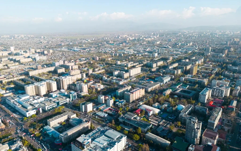
Urban growth and development present a complex puzzle for city planners worldwide. As populations swell and infrastructure demands increase, traditional methods of planning often struggle to keep pace with real-world needs. Fortunately, advancements in geospatial technology are providing new tools and insights that enable cities to evolve intelligently. By harnessing precise data and sophisticated mapping techniques, planners can create urban environments that are not only efficient but also resilient and sustainable. At the core of this technological shift lies the use of highly accurate devices like the RTK receiver, which offers pinpoint precision for geospatial measurements.
An RTK (Real-Time Kinematic) receiver, when combined with satellite-based positioning systems, enables city planners to gather real-time geospatial data with centimeter-level accuracy. This level of detail transforms how planners approach everything from infrastructure development to environmental conservation. The result is smarter, data-driven decision-making that translates into tangible benefits for city residents and the environment alike.
From Concept to Concrete: Enhancing Infrastructure Development
One of the most significant advantages of geospatial data in city planning is its ability to bridge the gap between conceptual designs and physical construction. Traditional planning methods often relied on static maps and estimations, which could lead to discrepancies when translating designs into reality. With advanced geospatial tools, planners now have access to dynamic, real-time data that provides a more accurate representation of the terrain and existing infrastructure.
For example, when designing new road networks or expanding public transport systems, planners can use geospatial data to analyze traffic patterns, optimize routes, and predict potential bottlenecks. The precise data provided by RTK receivers ensures that these designs fit seamlessly into the existing urban fabric, minimizing disruptions during construction. Moreover, integrating geospatial data with 3D modeling software allows stakeholders to visualize projects before they break ground, reducing the risk of costly design errors.
Geospatial technology also supports infrastructure maintenance. By continuously monitoring roads, bridges, and utilities, city planners can identify wear and tear early on, enabling proactive maintenance rather than reactive repairs. This approach not only extends the lifespan of infrastructure but also enhances public safety by preventing issues such as road collapses or utility failures.
Green Cities: Balancing Development with Nature
Urban development and environmental conservation are often seen as opposing forces. However, geospatial data is helping city planners find a balance between growth and sustainability. By mapping natural landscapes alongside urban environments, planners can identify critical green spaces, water bodies, and wildlife habitats that need protection.
For instance, when planning new residential or commercial developments, geospatial data can highlight flood-prone areas, enabling planners to design with natural water flow in mind. Rather than building over these areas, planners might incorporate green infrastructure such as parks or wetlands that help manage stormwater while providing recreational spaces for residents.
The use of RTK receivers and other geospatial tools also supports urban forestry initiatives. Accurate mapping allows cities to monitor tree canopies, track the health of urban forests, and plan green corridors that enhance air quality and biodiversity. These initiatives contribute to the creation of “green cities” that not only meet the needs of their residents but also mitigate the impacts of climate change.
Geospatial data is instrumental in achieving climate resilience. By analyzing historical weather patterns and geographical data, city planners can model how climate change might affect their cities. This information guides the development of adaptive infrastructure, such as flood defenses and heat-resistant public spaces, ensuring cities remain livable in the face of environmental challenges.
Real-Time Solutions for Dynamic Urban Challenges
Cities are living entities—constantly changing as new buildings rise, roads shift, and populations move. Geospatial technology equips planners with the tools needed to respond dynamically to these changes. Real-time data collection, facilitated by RTK receivers and satellite imagery, enables city officials to monitor developments as they happen and adjust plans accordingly.
Traffic management is a prime example of how real-time geospatial data can make a difference. Many cities struggle with congestion, leading to lost productivity and increased pollution. By analyzing live traffic data, city planners can adjust traffic light patterns, reroute public transport, or implement temporary measures to alleviate congestion. This level of responsiveness is only possible with up-to-date, accurate geospatial information.
Additionally, real-time geospatial data enhances emergency response strategies. In the event of a natural disaster or major accident, first responders rely on accurate maps to navigate affected areas and allocate resources efficiently. Geospatial technology can provide emergency teams with instant access to critical information, such as road closures, safe evacuation routes, and the locations of vulnerable populations. This capability not only saves time but can also save lives.
Geospatial data also plays a crucial role in urban analytics. By combining mapping data with demographic and economic information, city planners can gain insights into how neighborhoods evolve over time. This analysis supports policy decisions on housing, public services, and community development, helping cities become more inclusive and responsive to residents’ needs.

The Future of Smart City Planning
The integration of geospatial data into city planning is not just a trend but a transformative shift that will shape the future of urban development. As technology advances, the capabilities of geospatial tools will expand further, offering even greater accuracy and more sophisticated analytics. Innovations such as artificial intelligence (AI) and machine learning are likely to play a role, enabling predictive modeling that helps planners anticipate challenges before they arise.
Smart city initiatives, where technology is embedded into the urban infrastructure, are increasingly adopting geospatial data as a foundation for their operations. From smart traffic lights that adapt to real-time conditions to sensors that monitor environmental quality, the potential applications of geospatial technology are vast. As cities become smarter, the role of geospatial data will become even more critical, supporting initiatives that enhance quality of life, reduce environmental impact, and improve urban efficiency.
For city planners, this technology offers a new perspective on their work. Rather than designing static environments, they are now shaping dynamic, adaptable cities that can thrive in a rapidly changing world. The shift to data-driven planning is empowering cities to not only grow but to do so thoughtfully, balancing innovation with sustainability.
Embracing a Data-Driven Urban Future
As cities around the world strive to meet the demands of growing populations and environmental challenges, the adoption of geospatial data is becoming a necessity rather than a luxury. Tools like RTK receivers offer a level of precision and immediacy that allows city planners to turn ambitious visions into practical, impactful realities.
The future of urban planning lies in data—data that is not only accurate but also actionable. By leveraging the power of geospatial technology, planners can make informed decisions that enhance infrastructure, preserve natural spaces, and improve residents’ quality of life. As technology continues to advance, so too will the possibilities for smarter, more resilient cities. With the right data, there is no limit to what can be achieved in the ever-evolving landscape of modern urban environments.
Further Reading


